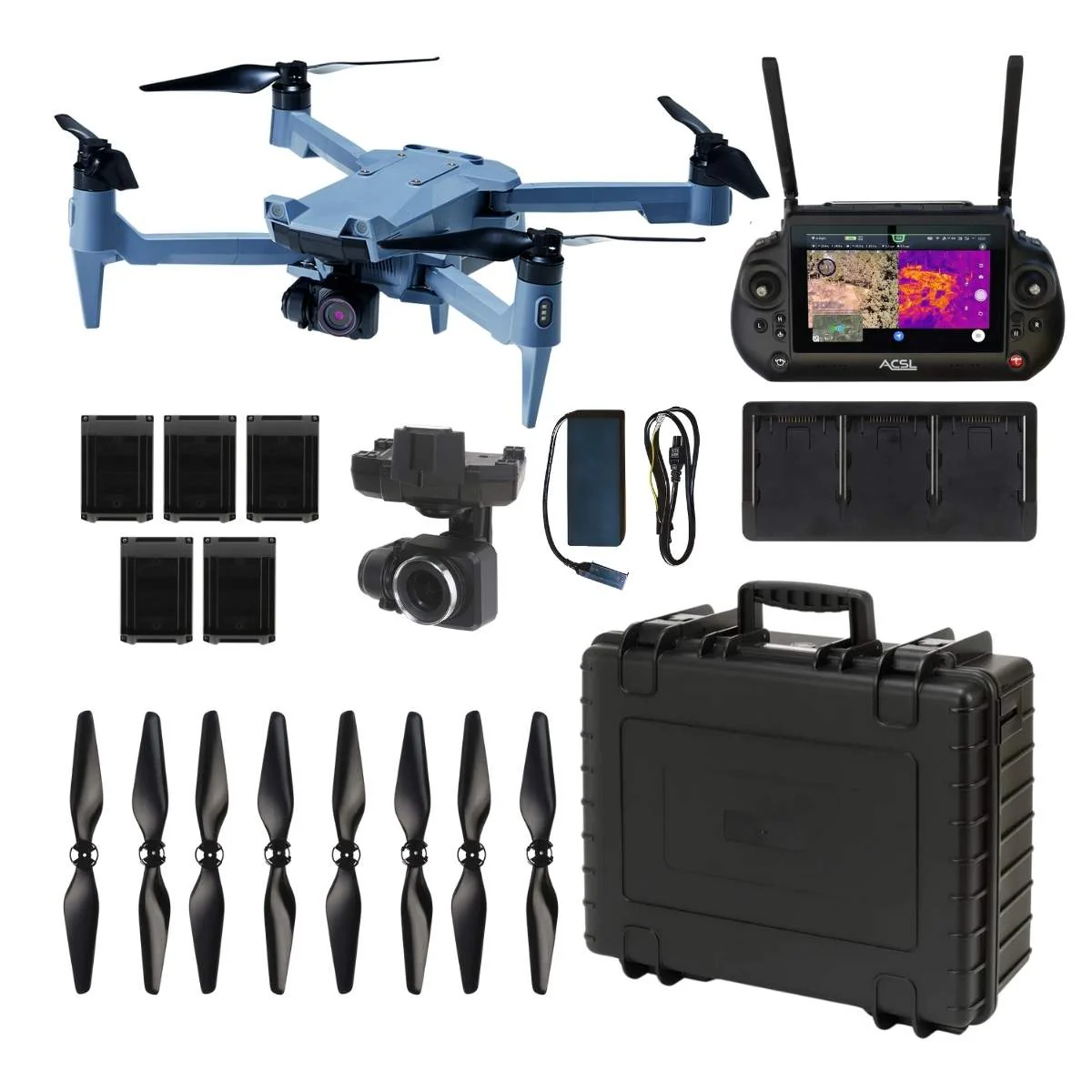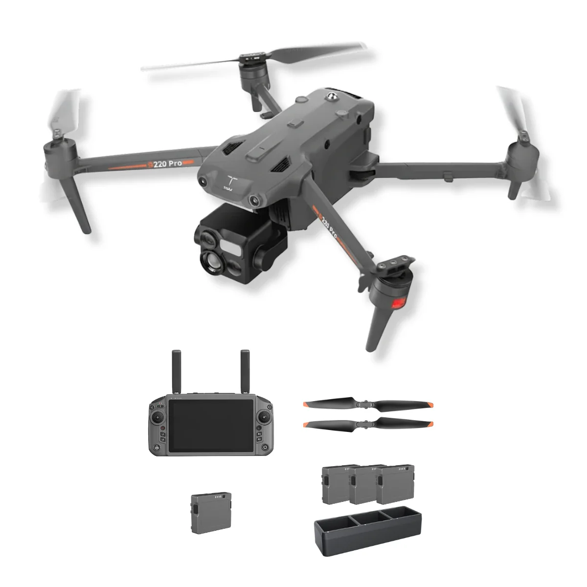
GDU S220 Pro 640 Version Inspection/Hunting Bundle
Drone use in connection with hunting is limited, regulated, or prohibited in many states and local jurisdictions. Depending on the area, these restrictions may apply to activities such as scouting, locating animals, tracking, or assisting with the recovery of game.
Customers are solely responsible for reviewing and following all applicable federal, state, and local laws, wildlife regulations, and land-use requirements before using any drone for hunting-related or other outdoor purposes.
Dronefly does not provide legal advice or interpretation of hunting laws and accepts no responsibility or liability for any unlawful, improper, or unauthorized drone operation. Always verify current regulations with your state wildlife agency or other local authorities before use.
Standardized Thermal Imaging Platform for Scalable Inspection Workflows
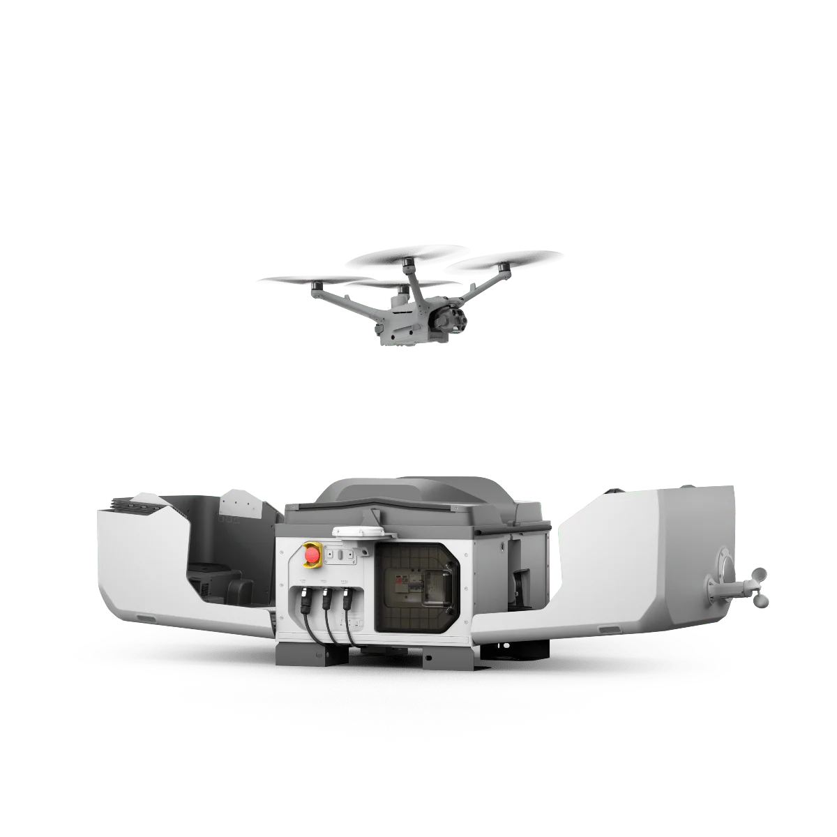
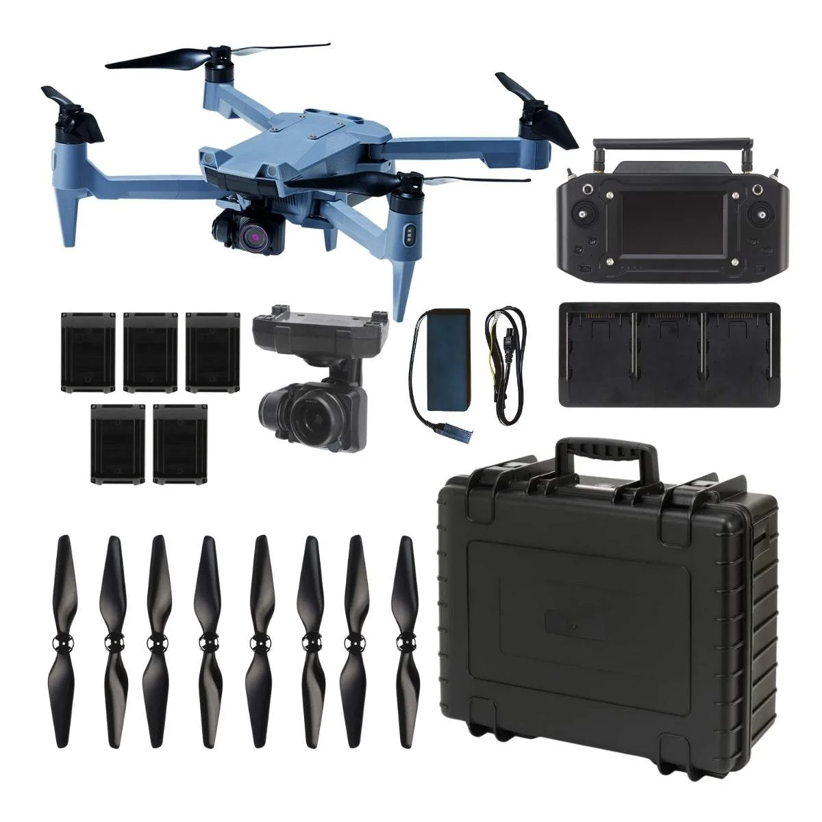
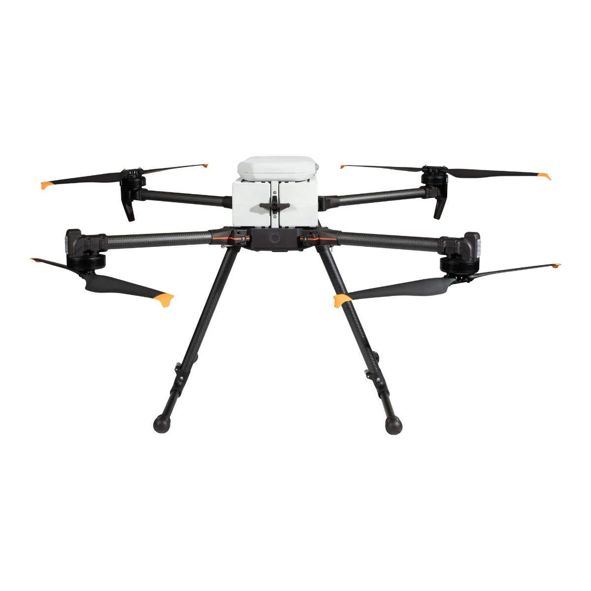
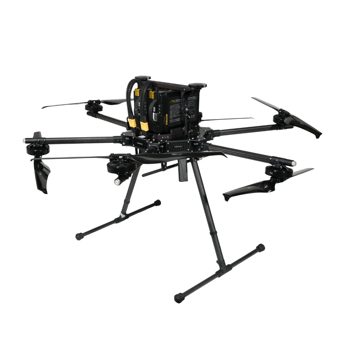
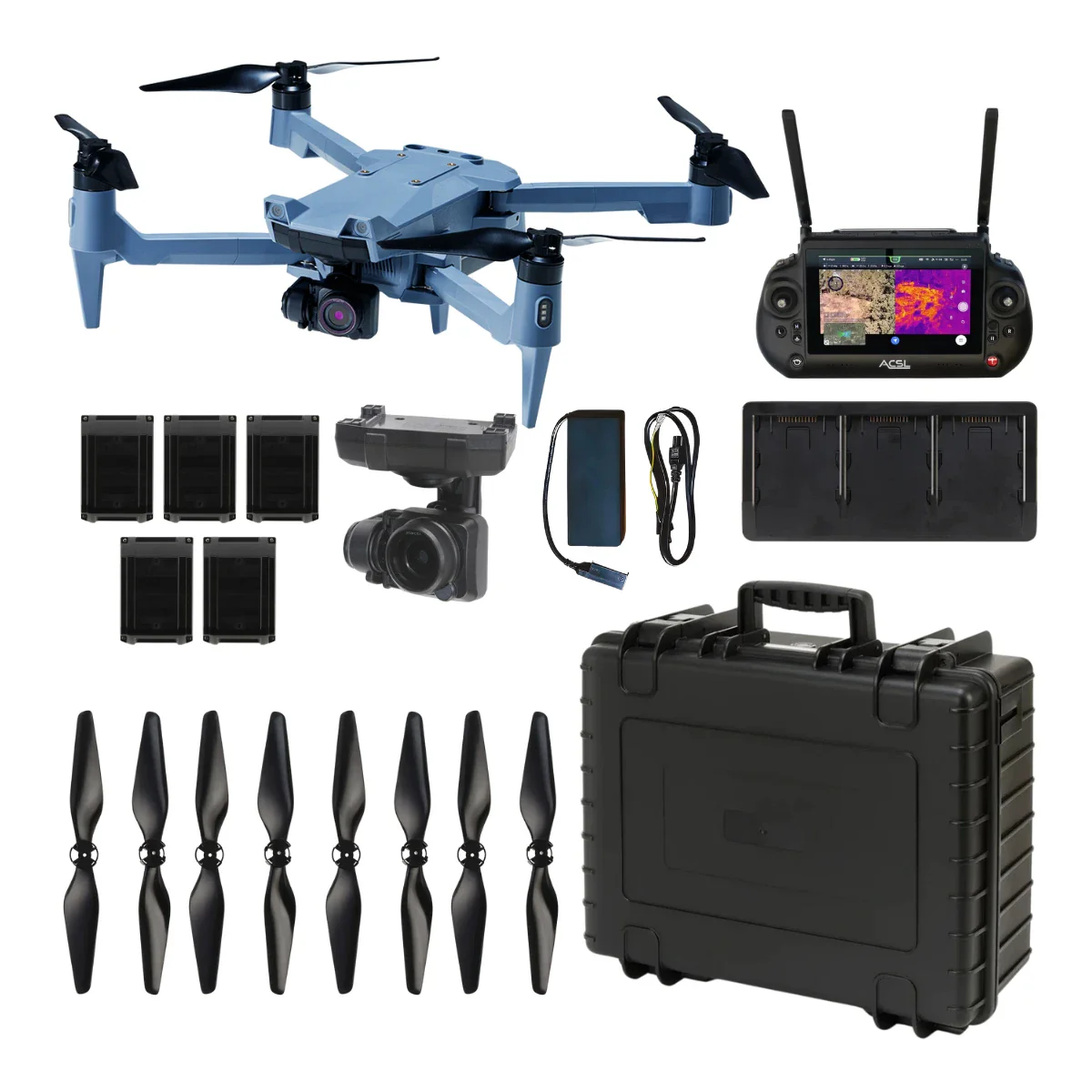
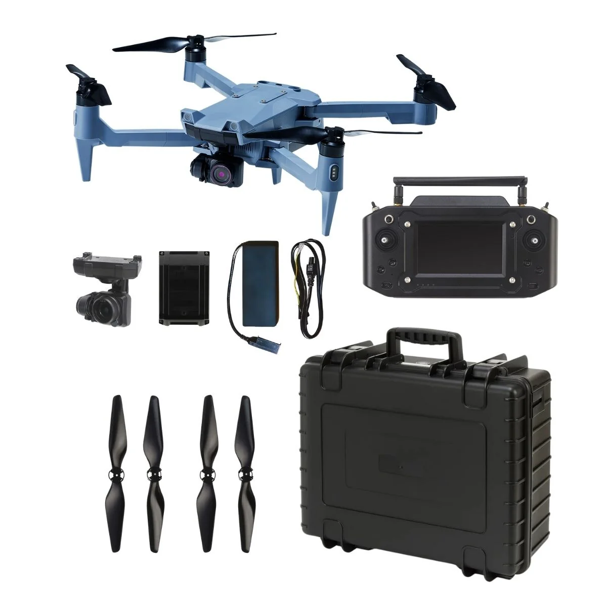
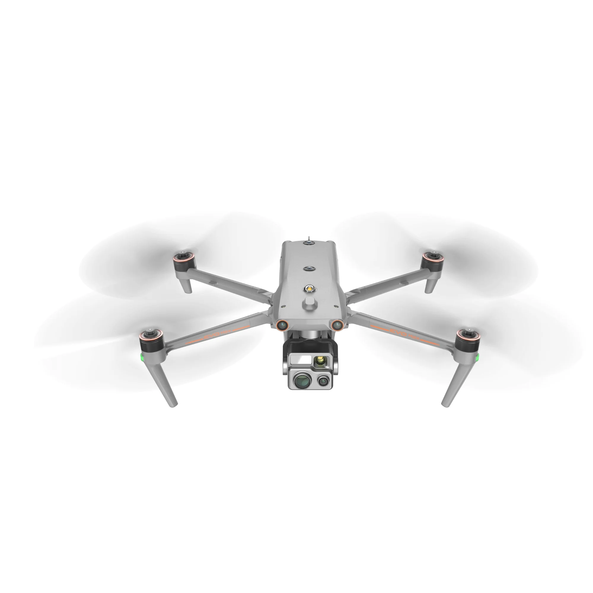
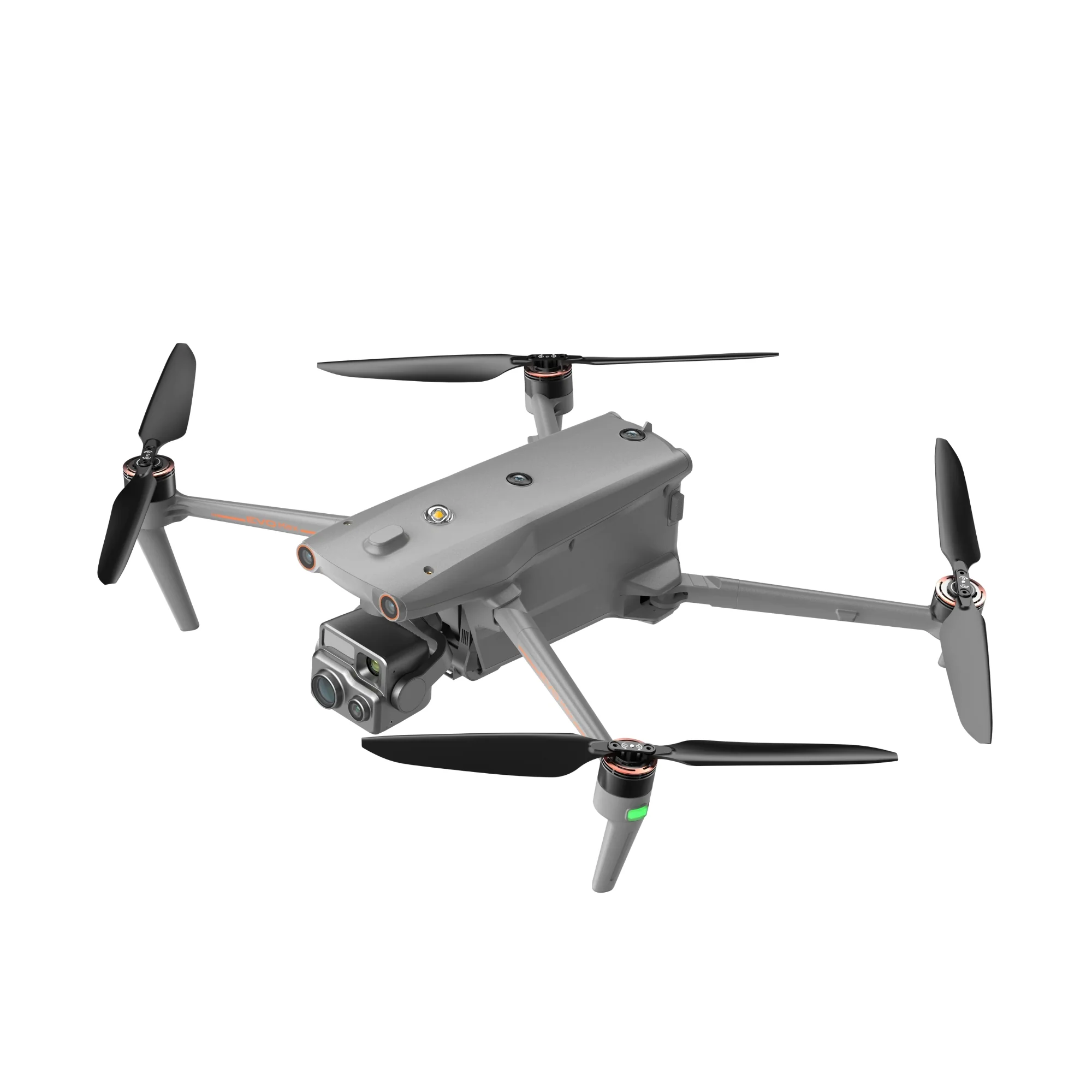
The GDU S220 Pro 640 Version Inspection Bundle / Hunting Bundle is structured as a deployable inspection system built around industry-standard thermal imaging and multi-sensor data capture.
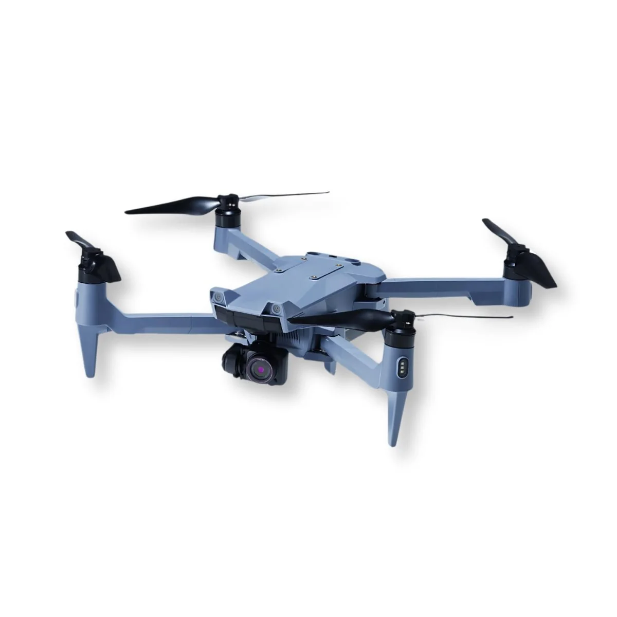
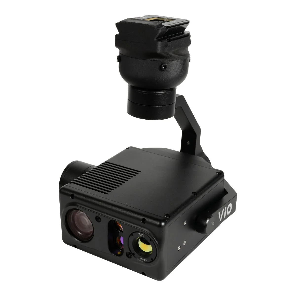
It integrates a wide-angle camera, 48MP zoom camera, 640 × 512 thermal imager, and laser rangefinder into a single platform, enabling organizations to standardize aerial data collection across inspection, monitoring, and field observation workflows.
This configuration focuses on operational continuity, bundling additional batteries and essential components to reduce downtime and support extended deployment cycles.
With up to 41 minutes of flight time, 15 km (9.32 miles) transmission range, and integrated AI processing, it enables consistent data acquisition across distributed teams and large-area operations.
Key Features and Benefits
- Integrated quad sensor system: Combines visual, thermal, and ranging data capture.
- Industry-standard thermal resolution: 640 × 512 for inspection and monitoring workflows.
- Long-range imaging capability: 10× optical and 160× hybrid zoom system.
- Laser ranging integration: Measures distances from 10 to 1500 meters.
- Extended operational uptime: Up to 41 minutes flight time per deployment cycle.
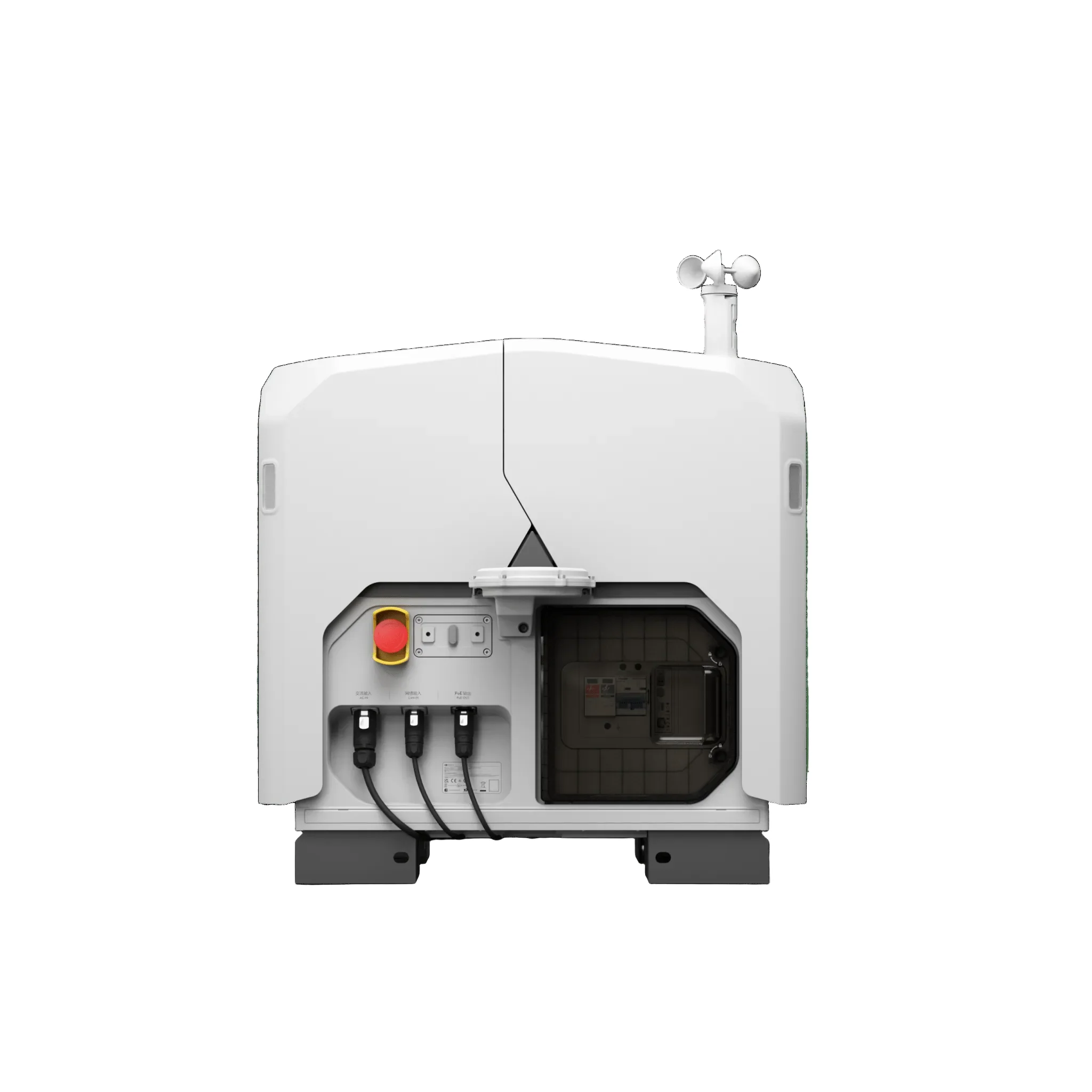
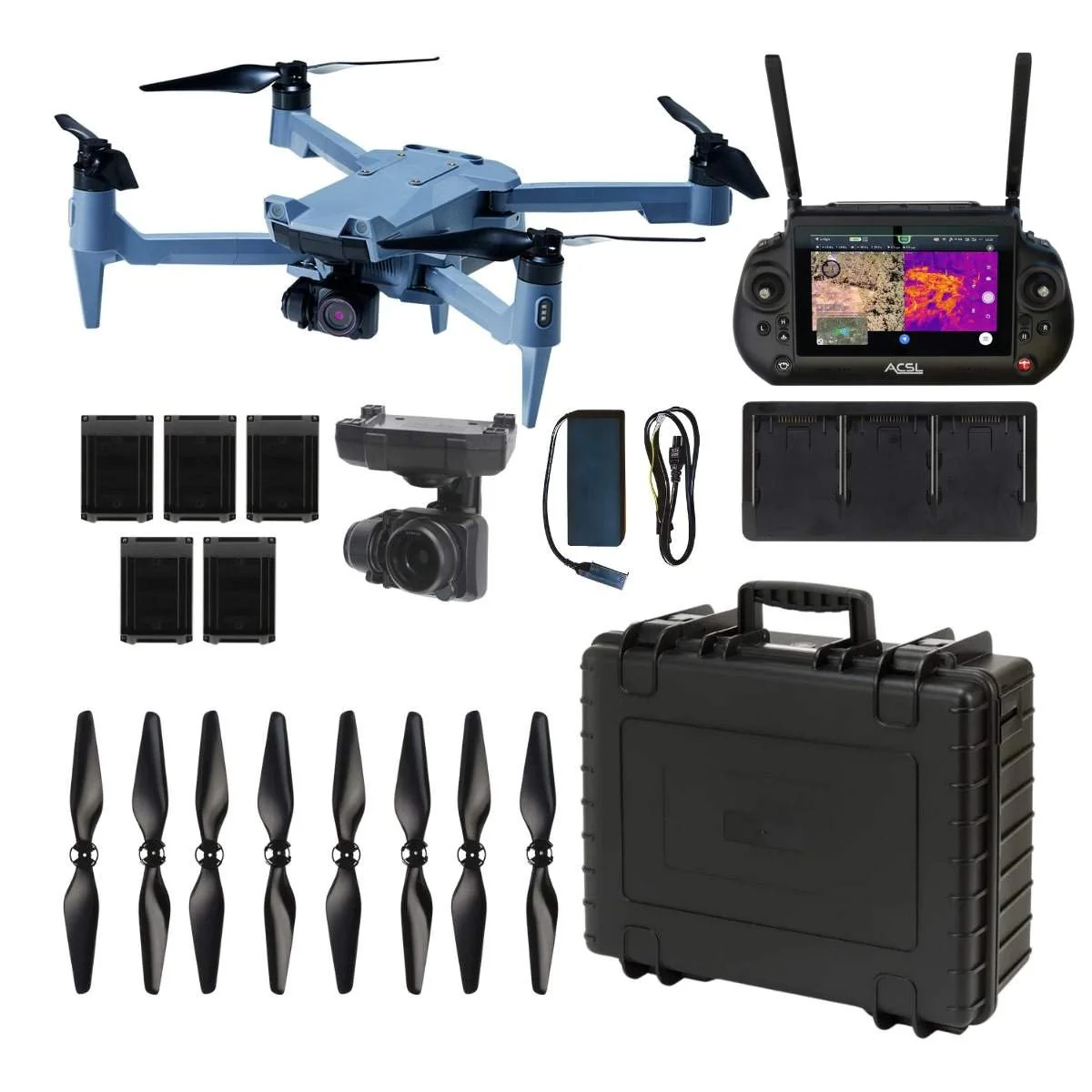
- Multi-battery configuration: Includes three batteries and hub for sustained operations.
- AI-enabled processing: Supports automated detection and tracking across missions.
- Omnidirectional sensing system: Improves navigation reliability in complex environments.
- GNSS-denied capability: Enables operations in indoor and obstructed environments.
Standardizing Thermal Inspection Across Distributed Operations
Organizations operating across multiple sites require consistent data outputs and repeatable workflows.
The 640 × 512 thermal sensor provides a widely adopted standard for inspection, allowing teams to align processes without requiring high-resolution thermal systems where not necessary.
Combined with synchronized visual and zoom imaging, the platform enables consistent detection, verification, and documentation across assets.
With integrated AI processing and up to 100T edge computing capability, the system can assist in identifying anomalies and reducing manual review time.
The extended battery configuration ensures continuity across inspection cycles, while long-range transmission maintains connectivity between field teams and command units.
Compatibility and System Integration
- Unified payload architecture: Combines thermal, visual, and ranging sensors in one system.
- PSDK interface: Supports integration with additional payloads and modules.
- GDU Flight II software: Enables automated flight planning and repeatable mission execution.
- UVER platform integration: Supports cloud-based data synchronization and fleet management.
- Multi-network communication: Supports Wi-Fi, Bluetooth, and network-based connectivity.
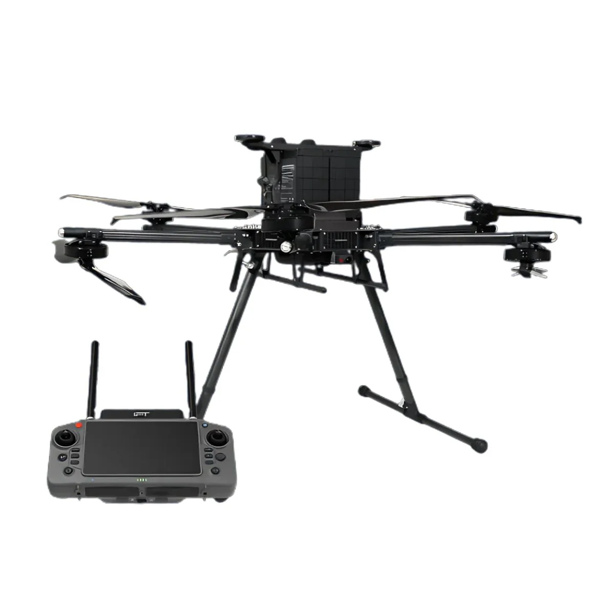
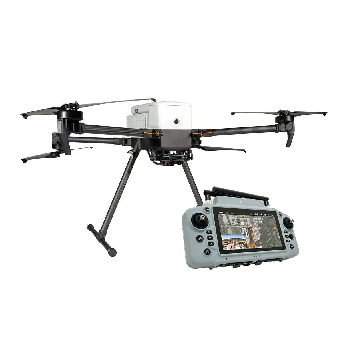
- PYK-200 controller system: Provides centralized aircraft and payload control interface.
Applications and Use Cases
- Industrial inspection programs: Standardize thermal data collection across multiple assets.
- Infrastructure monitoring: Identify thermal anomalies in energy and mechanical systems.
- Facility management: Conduct repeatable inspections of buildings and equipment.
- Environmental observation: Monitor land conditions and surface temperature variations.
- Field operations support: Provide aerial visibility in low-light or low-visibility environments.
- Wildlife observation workflows: Enable thermal-based situational awareness where permitted.
Designed for Scalable Deployment and Operational Consistency
The GDU S220 Pro 640 Version provides a balanced platform for organizations that require consistent thermal inspection capability without the overhead of higher-resolution systems.
Its integrated sensors, extended battery configuration, and AI-assisted processing allow teams to scale operations while maintaining standardized outputs across deployments.
Dronefly works with organizations to implement UAV systems that align with operational workflows and data requirements. Our team can help integrate the S220 Pro into your inspection programs and expand its capabilities as your needs evolve.
Original: $7,325.00
-65%$7,325.00
$2,563.75Product Information
Product Information
Shipping & Returns
Shipping & Returns
Description
Drone use in connection with hunting is limited, regulated, or prohibited in many states and local jurisdictions. Depending on the area, these restrictions may apply to activities such as scouting, locating animals, tracking, or assisting with the recovery of game.
Customers are solely responsible for reviewing and following all applicable federal, state, and local laws, wildlife regulations, and land-use requirements before using any drone for hunting-related or other outdoor purposes.
Dronefly does not provide legal advice or interpretation of hunting laws and accepts no responsibility or liability for any unlawful, improper, or unauthorized drone operation. Always verify current regulations with your state wildlife agency or other local authorities before use.
Standardized Thermal Imaging Platform for Scalable Inspection Workflows
The GDU S220 Pro 640 Version Inspection Bundle / Hunting Bundle is structured as a deployable inspection system built around industry-standard thermal imaging and multi-sensor data capture.
It integrates a wide-angle camera, 48MP zoom camera, 640 × 512 thermal imager, and laser rangefinder into a single platform, enabling organizations to standardize aerial data collection across inspection, monitoring, and field observation workflows.
This configuration focuses on operational continuity, bundling additional batteries and essential components to reduce downtime and support extended deployment cycles.
With up to 41 minutes of flight time, 15 km (9.32 miles) transmission range, and integrated AI processing, it enables consistent data acquisition across distributed teams and large-area operations.
Key Features and Benefits
- Integrated quad sensor system: Combines visual, thermal, and ranging data capture.
- Industry-standard thermal resolution: 640 × 512 for inspection and monitoring workflows.
- Long-range imaging capability: 10× optical and 160× hybrid zoom system.
- Laser ranging integration: Measures distances from 10 to 1500 meters.
- Extended operational uptime: Up to 41 minutes flight time per deployment cycle.
- Multi-battery configuration: Includes three batteries and hub for sustained operations.
- AI-enabled processing: Supports automated detection and tracking across missions.
- Omnidirectional sensing system: Improves navigation reliability in complex environments.
- GNSS-denied capability: Enables operations in indoor and obstructed environments.
Standardizing Thermal Inspection Across Distributed Operations
Organizations operating across multiple sites require consistent data outputs and repeatable workflows.
The 640 × 512 thermal sensor provides a widely adopted standard for inspection, allowing teams to align processes without requiring high-resolution thermal systems where not necessary.
Combined with synchronized visual and zoom imaging, the platform enables consistent detection, verification, and documentation across assets.
With integrated AI processing and up to 100T edge computing capability, the system can assist in identifying anomalies and reducing manual review time.
The extended battery configuration ensures continuity across inspection cycles, while long-range transmission maintains connectivity between field teams and command units.
Compatibility and System Integration
- Unified payload architecture: Combines thermal, visual, and ranging sensors in one system.
- PSDK interface: Supports integration with additional payloads and modules.
- GDU Flight II software: Enables automated flight planning and repeatable mission execution.
- UVER platform integration: Supports cloud-based data synchronization and fleet management.
- Multi-network communication: Supports Wi-Fi, Bluetooth, and network-based connectivity.
- PYK-200 controller system: Provides centralized aircraft and payload control interface.
Applications and Use Cases
- Industrial inspection programs: Standardize thermal data collection across multiple assets.
- Infrastructure monitoring: Identify thermal anomalies in energy and mechanical systems.
- Facility management: Conduct repeatable inspections of buildings and equipment.
- Environmental observation: Monitor land conditions and surface temperature variations.
- Field operations support: Provide aerial visibility in low-light or low-visibility environments.
- Wildlife observation workflows: Enable thermal-based situational awareness where permitted.
Designed for Scalable Deployment and Operational Consistency
The GDU S220 Pro 640 Version provides a balanced platform for organizations that require consistent thermal inspection capability without the overhead of higher-resolution systems.
Its integrated sensors, extended battery configuration, and AI-assisted processing allow teams to scale operations while maintaining standardized outputs across deployments.
Dronefly works with organizations to implement UAV systems that align with operational workflows and data requirements. Our team can help integrate the S220 Pro into your inspection programs and expand its capabilities as your needs evolve.