Autel Mapper
Autel Mapper: Enterprise Drone Photogrammetry Platform For Mapping And Modeling
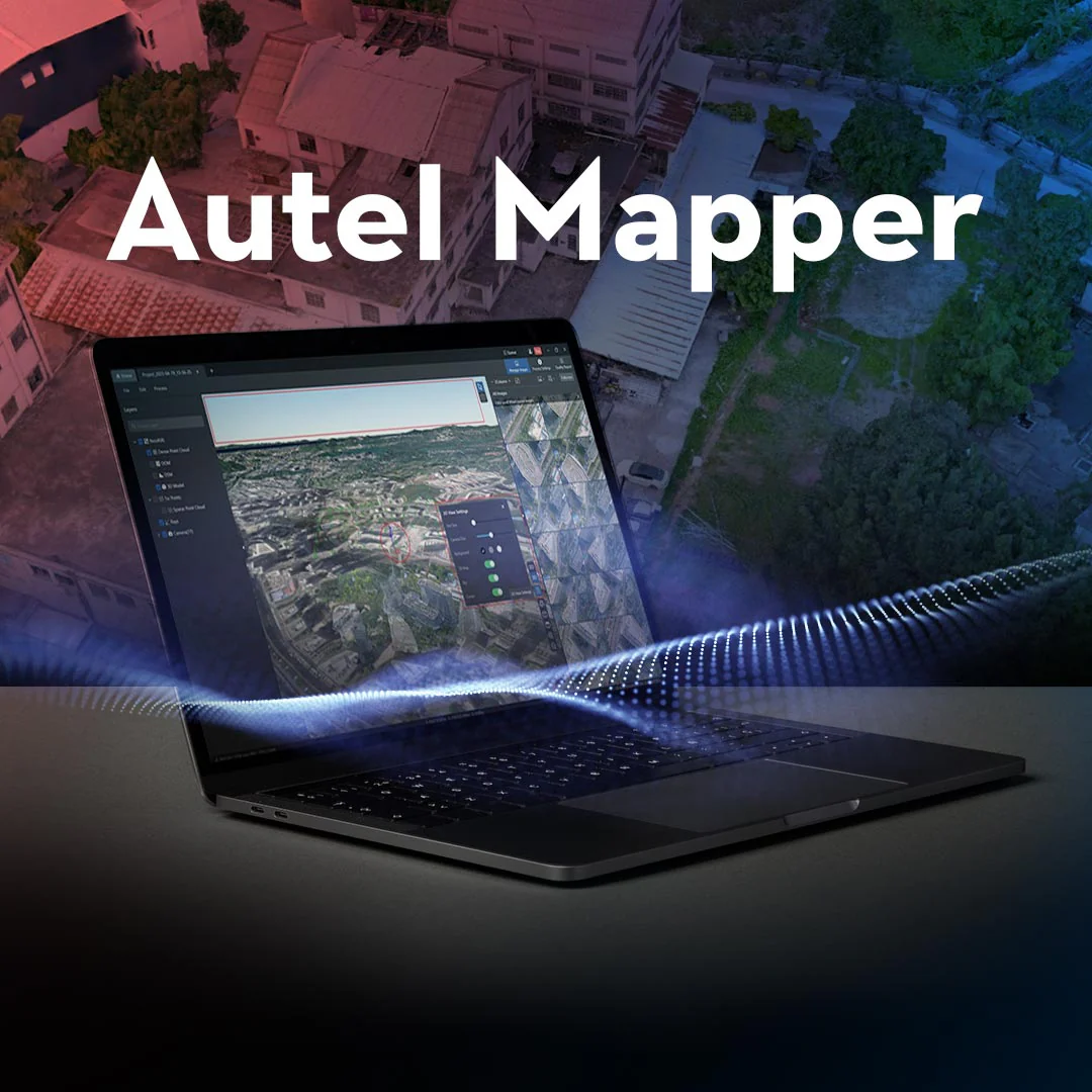
Autel Mapper is a desktop photogrammetry processing platform designed to transform drone imagery into accurate mapping and modeling outputs. It reconstructs aerial datasets into orthomosaics, digital surface models, point clouds, and 3D mesh models used for geospatial analysis, surveying, and infrastructure inspection. The software supports aerial triangulation, reconstruction pipelines, coordinate system configuration, and ground control integration.
When paired with Autel enterprise drones, Autel Mapper enables mapping professionals to convert captured imagery into reliable spatial datasets for inspection, documentation, and planning workflows.
Autel Mapper Mapping And Reconstruction Platform Highlights
- Photogrammetry processing converts drone imagery into professional mapping deliverables
- Orthomosaic reconstruction generates georeferenced aerial maps for surveying workflows
- Dense point cloud outputs represent terrain and infrastructure geometry
- 3D mesh modeling produces textured models for inspection and visualization
- Aerial triangulation calculates camera orientation and positional alignment
- Ground control integration improves mapping accuracy using GCP workflows
- Reconstruction task queue manages multi-project photogrammetry processing pipelines
- Flexible coordinate systems support WGS84 UTM and custom projections
- Enterprise drone compatibility supports Autel EVO II, EVO Max, and Dragonfish platforms

Autel Mapper enables organizations to process aerial imagery into standardized mapping outputs for engineering, surveying, and inspection workflows. Its reconstruction pipeline supports accurate spatial modeling and export formats compatible with professional GIS and CAD software. These capabilities help teams turn drone imagery into practical geospatial datasets used across infrastructure and mapping operations.
When you purchase Autel Mapper from Dronefly, you receive professional software licensing from a trusted UAV dealer serving enterprise drone operators. Dronefly helps customers select the right mapping software tools to support inspection, surveying, and geospatial workflows.
Purchase Autel Mapper from Dronefly to support your drone-based mapping and modeling operations.
Original: $149.00
-65%$149.00
$52.15Product Information
Product Information
Shipping & Returns
Shipping & Returns
Description
Autel Mapper: Enterprise Drone Photogrammetry Platform For Mapping And Modeling
Autel Mapper is a desktop photogrammetry processing platform designed to transform drone imagery into accurate mapping and modeling outputs. It reconstructs aerial datasets into orthomosaics, digital surface models, point clouds, and 3D mesh models used for geospatial analysis, surveying, and infrastructure inspection. The software supports aerial triangulation, reconstruction pipelines, coordinate system configuration, and ground control integration.
When paired with Autel enterprise drones, Autel Mapper enables mapping professionals to convert captured imagery into reliable spatial datasets for inspection, documentation, and planning workflows.
Autel Mapper Mapping And Reconstruction Platform Highlights
- Photogrammetry processing converts drone imagery into professional mapping deliverables
- Orthomosaic reconstruction generates georeferenced aerial maps for surveying workflows
- Dense point cloud outputs represent terrain and infrastructure geometry
- 3D mesh modeling produces textured models for inspection and visualization
- Aerial triangulation calculates camera orientation and positional alignment
- Ground control integration improves mapping accuracy using GCP workflows
- Reconstruction task queue manages multi-project photogrammetry processing pipelines
- Flexible coordinate systems support WGS84 UTM and custom projections
- Enterprise drone compatibility supports Autel EVO II, EVO Max, and Dragonfish platforms
Autel Mapper enables organizations to process aerial imagery into standardized mapping outputs for engineering, surveying, and inspection workflows. Its reconstruction pipeline supports accurate spatial modeling and export formats compatible with professional GIS and CAD software. These capabilities help teams turn drone imagery into practical geospatial datasets used across infrastructure and mapping operations.
When you purchase Autel Mapper from Dronefly, you receive professional software licensing from a trusted UAV dealer serving enterprise drone operators. Dronefly helps customers select the right mapping software tools to support inspection, surveying, and geospatial workflows.
Purchase Autel Mapper from Dronefly to support your drone-based mapping and modeling operations.